|
Southwest wilderness coast
Tasmanians are lucky, having one of the world's great wilderness coasts only a few hours (or days) away, in the southwest. Without settlements or roads, access is by foot (via the famous South Coast Track) or by boat, or by aircraft (there is a small airstrip at Melaleuca, as well as hard sand on the beaches). You can see the airstrip marked on the Google Earth image below.
We had an enthusiastic send-off from the sailing club dog....
Leaving Hobart...
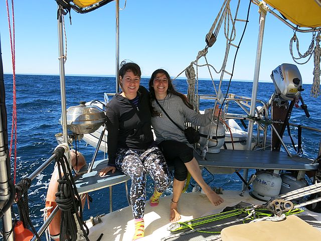
Crew on this trip were Alana Klaver (New Zealand) and Silvia Di Domenicantonio (Italy). Both wonderful at cooking! So the trip was like living on a floating restaurant!.
We left Hobart at 4pm on Saturday January 30, and had a slow trip southwards down the east coast of Bruny Island, with the autopilot misbehaving, and weak and changeable winds. After clearing Bruny we turned westwards, sailing towards South East Cape, Maatsuyker Island, and South West Cape. Our initial plan was to keep the boat running west all night, but in fact we were tired, and decided we needed to sleep in a quiet harbour. Cockle Creek, in Recherche Bay, seemed an obvious resting place.
It was the early hours of Sunday morning, maybe 2 am. The night was dark under a cloudy sky, and raining. Alana and Silvia were asleep. I could hear breathing on the port side of the boat. Something was swimming beside us... too dark to see much, but it looked like a large dolphin or a small whale, it was a bit more than half the length of Ocean Child; I estimated six metres. Just one animal. When we arrived in Recherche Bay, about 6 am, it was still swimming beside us. In the early morning light I could see it underneath the boat, half on its side, looking up at Ocean Child's hull. Judging by the dorsal fin, it was a young humpback whale... at this time of year it should have been in Antarctic waters with its mother. As we reached shallow water it vanished. No photos and no clues...
Above, Recherche Bay. OK, I'm cheating a bit here... the aerial photos are from a website Bruny Scenic Flights... so please consider patronising them on your next excursion to Tasmania! Below, Maatsuyker Island.
Somewhere south of Maatsuyker Island we had a brief visit from a group of dolphins... they seemed the same size and colouring as the ones we were used to around Maria Island on earlier trips, but they behaved differently. Instead of gathering around Ocean Child's bow, they darted at great speed across the bow, and disappeared after only a minute or two.
Unlike our trip across the Pacific between Fiji and New Caledonia where the seas seemed empty of living things, the seas here seemed full of life. Albatross, always so beautiful, but today struggling with the lack of wind... short-tailed shearwaters, and prions. And seals. Below, South West Cape.
Itinerary: Saturday January 30, night - south of Bruny Island. Sunday night, Southwest Cape. Monday, Tuesday, Wednesday nights - Spain Bay. Thursday and Friday nights, Melaleuca Inlet off Bathurst Harbour. Saturday night - Schooner Cove, Sunday night - south of Maatsuyker Island. Monday night, Cockle Creek. Tuesday and Wednesday nights, Partridge Island. Thursday night, Barnes Bay. Friday night, RYCT Hobart. 13 days.
Below, an early morning mist rainbow.
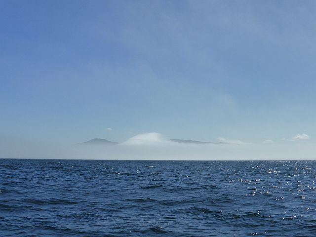
Early Monday morning, January 1. A quiet misty morning... with almost no wind. We had been running all night on a breath of air in the sails and the motor not much more than idling. We were longing for enough wind so we could shut the motor down. We could see nothing but mist. We knew South West Cape was there... the OpenCPN chart showed it only 10nm away, but no sign of it in the mist. Then 5nm, still nothing. At last at 2nm, it appeared out of the mist. Stunning... In the photo below, the Cape is hiding in it's own special mist cloud, that's the white "bump" in the middle of the photo..
All photos, unless otherwise credited: by Silvia Di Domenicantonio
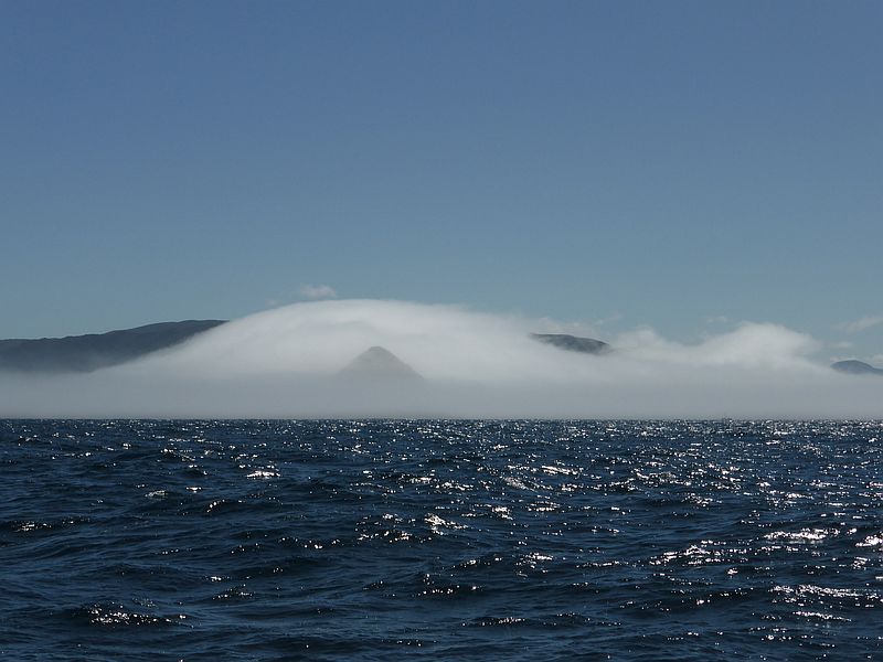
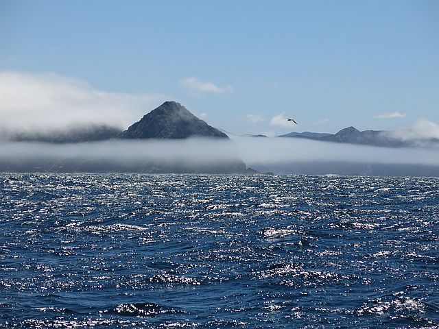
Above, the Cape is peeping out of its cloud...
The three photos above are sequential, as the Cape slowly appears out of a misty veil.
After rounding the Cape we turned north. Two commercial fishing boats were heading south, neither emitting AIS signals. It's a measure of the corruption and incompetence of Australian and Tasmanian Fisheries Agencies that these boats continue to operate without AIS transponders. I won't say more here... but if you're interested please read my book on Australian Fisheries management. It's a technical read; I suggest starting with the chapter on the Orange Roughy fishery. :http://www.onlyoneplanet.com/marineOverfishingUnderRegulation_6mmOffset_withCitation.doc
Shades of grey....
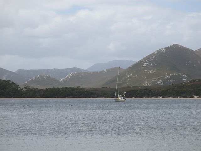
Below, Spain Bay, a few kilometres south of Port Davey, offers good protection from southwest winds (the prevailing wind). The mountains seem to have a scattering of snow, but see below.
Ocean Child at Spain Bay.
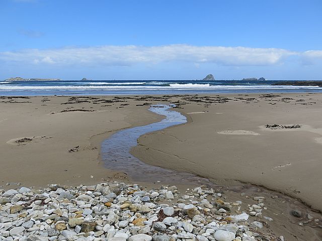
The beach at Spain Bay. Much of the landscape here is composed of white quartz, here on the beach. Sometimes the mountains look as though they have freshly fallen snow... but it's white quartz.
We all liked this photo... beautiful colours and textures. The water was surprisingly warm, 24 Celsius outside the bay, and 21 inside... Photo: Jon, permission, Alana.
Stephenson Bay is open to the southwest... wild and windswept...
A beach with only animal tracks, no human footprints...
We never got to the end of the beach... maybe next time....
A cloudy sunset....
The next day we moved on through Bathurst Channel eastwards ...
to Melaleuca Bay. Above, Bathurst Channel viewed from the west, looking east.
At Melaleuca Bay the house and pier once owned by Clyde and Winsome Clayton provide visitors with shelter and water. Winsome was the sister of the famous Deny King of Melaleuca. Since the Claytons' death some years ago the house has been maintained by the Parks Service and the volunteer group Friends of Melaleuca. I have no photos but the image below shows the (often) peaceful setting in Melaleuca Bay.
We took the dinghy south down Melaleuca Creek towards the airfield. Two photos below: Jon.
We stopped en route to do some washing and sunbaking... yes, that's Alana on the beach...
From the Claytons' house there's a walk to Mount Beattie (275m), just across the Channel from Mount Rugby (778m). We thought about climbing Mount Rugby using the track which starts from the Channel, but decided on the Mount Beattie walk instead.
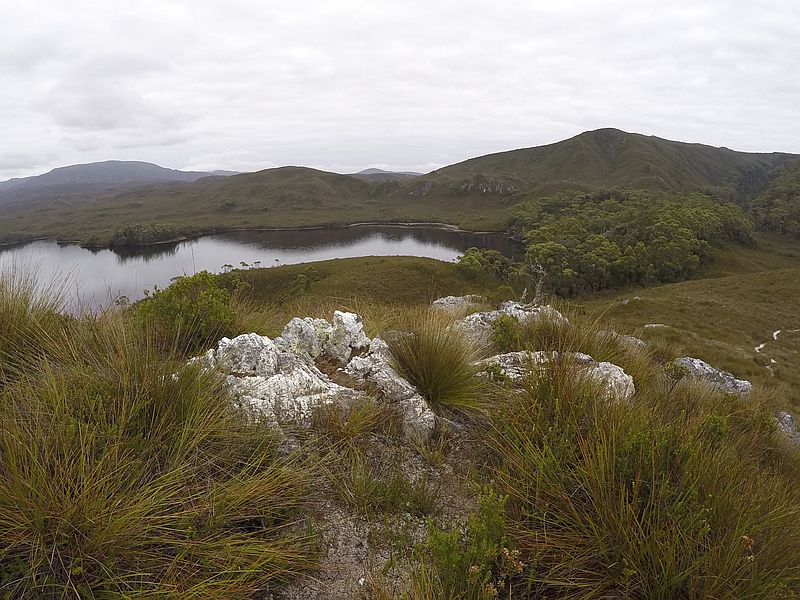
The view from Mount Beattie, showing the interesting juxtaposition of dense forest with the more common healthland... with boundaries as clear as if they had been cut with a knife. The rock is white quartz.
On the way west we stopped one night at Schooner Cove, and Alana and Silvia walked to Schooner Hill while I serviced the anchor winch. The yacht Amnesia was there too, with my friend Bev (met in Vuda Fiji).
The Breaksea Islands provide a picturesque boundary to Port Davey. Here photographed as we headed out to sea on our journey home.
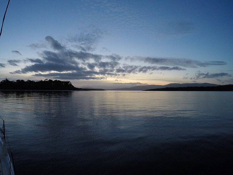
Below, early morning colours... approaching Cockle Creek for our second stop there.
Below, sunset at Partridge Island, almost our last stop before heading back to Hobart..
Day 13, heading back towards Hobart. Photo: Jon.
An albatross sunset...
|